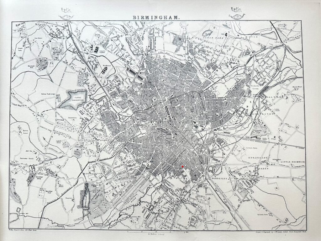
This is an illustration of a Map of Birmingham taken from the Weekly Dispatch Atlas and drawn by J W Lowry circa 1863. Over the years we have collected a number of these prints of Historic Birmingham and will occasionally change this picture for others in our collection. From this map it is noted that we are located in Brewery Street, which was later changed to a continuation of Alcester Street and our current address. We are located on the map under the small red dot.